Field photography and observation
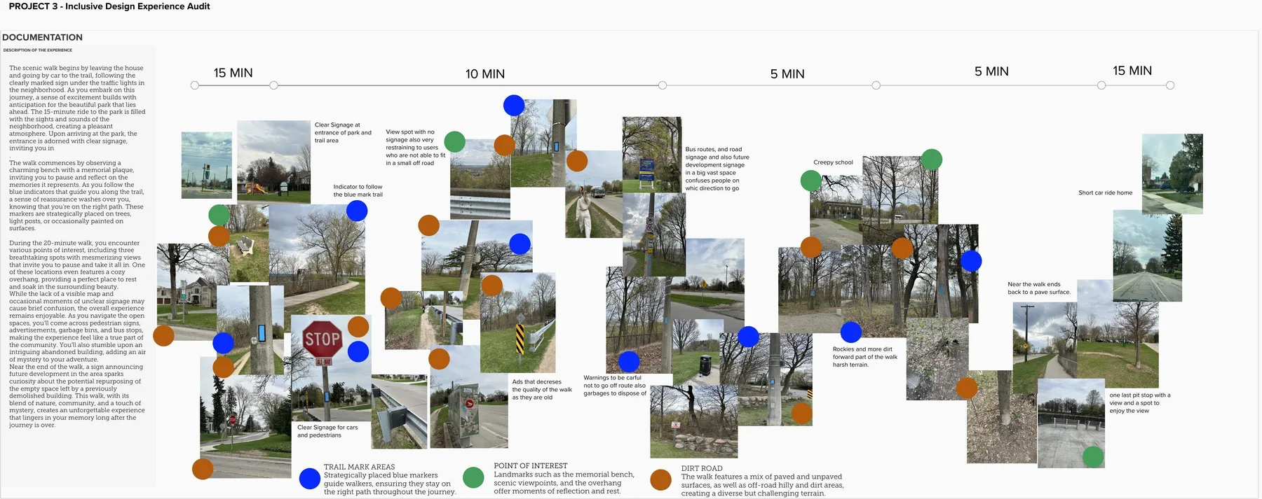
Documented surfaces, landmarks, signage, rest points and moments of uncertainty along the route.
Field observation, journey mapping & accessibility
Map one ordinary walk closely enough to see who it leaves behind.
An inclusive-design audit of a walking route: observation, journey mapping, and barrier assessment.
Project status
Academic field-research exercise · Winter 2023 · observational audit, not participant testing
Project boundary. This is an academic project — not a claim of commissioned, built, tested, or approved work beyond what this page documents. An observational audit by one researcher; recommendations are provisional and were not tested with participants.
My contribution
Solo field researcher: route observation, photo documentation, experience mapping, and the barrier analysis + recommendations.
01 / Design decisions
The audit follows a Scenic Road walk from a car journey and marked entrance through paved, unpaved and off-road conditions. Photographs, time estimates and landmark notes keep the analysis grounded in one observed route.
02 / Design decisions
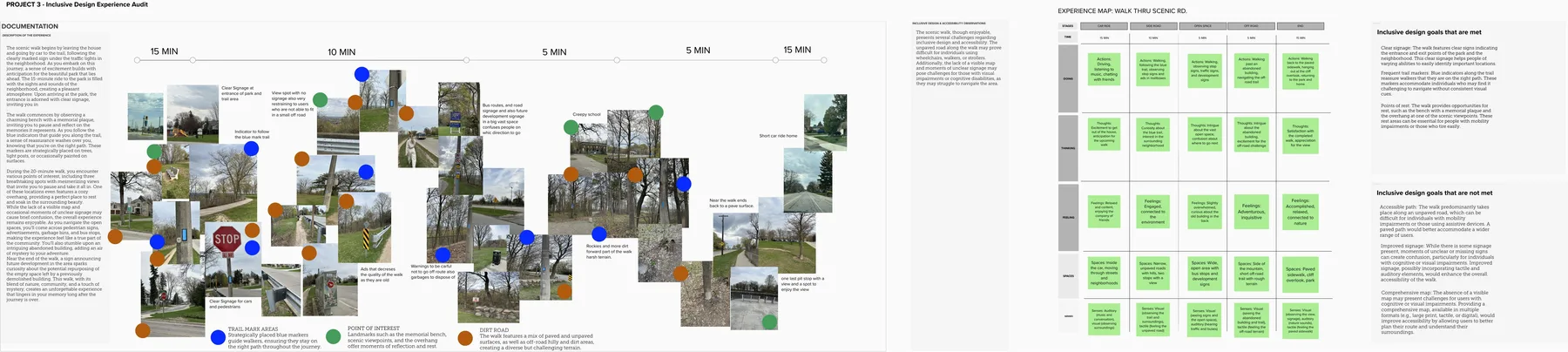
A long-form experience map connects trail markers, rest points, roadway crossings, open space and difficult terrain. It shows where reassurance builds and where unclear wayfinding changes the experience.
03 / Design decisions
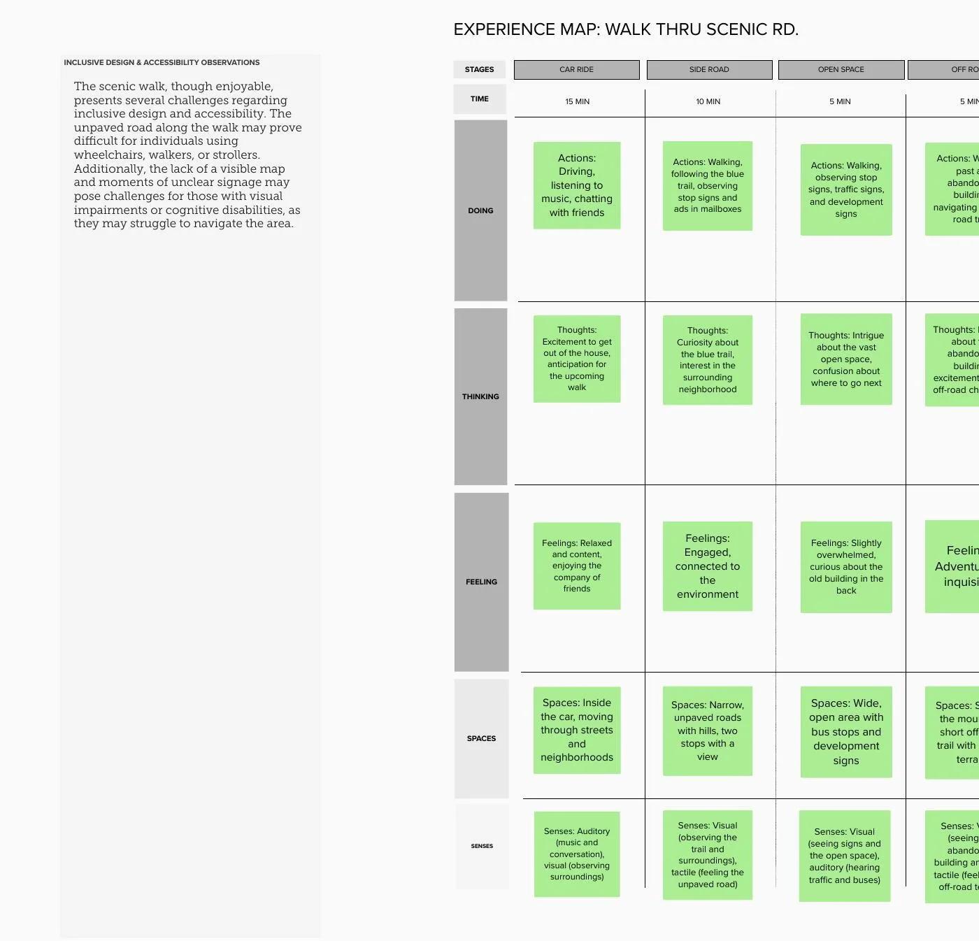
Five stages organize doing, thinking, feeling, spaces and senses. This makes accessibility more than a final checklist by showing how surface, width, traffic, signage and rest opportunities affect the journey over time.
04 / Design decisions
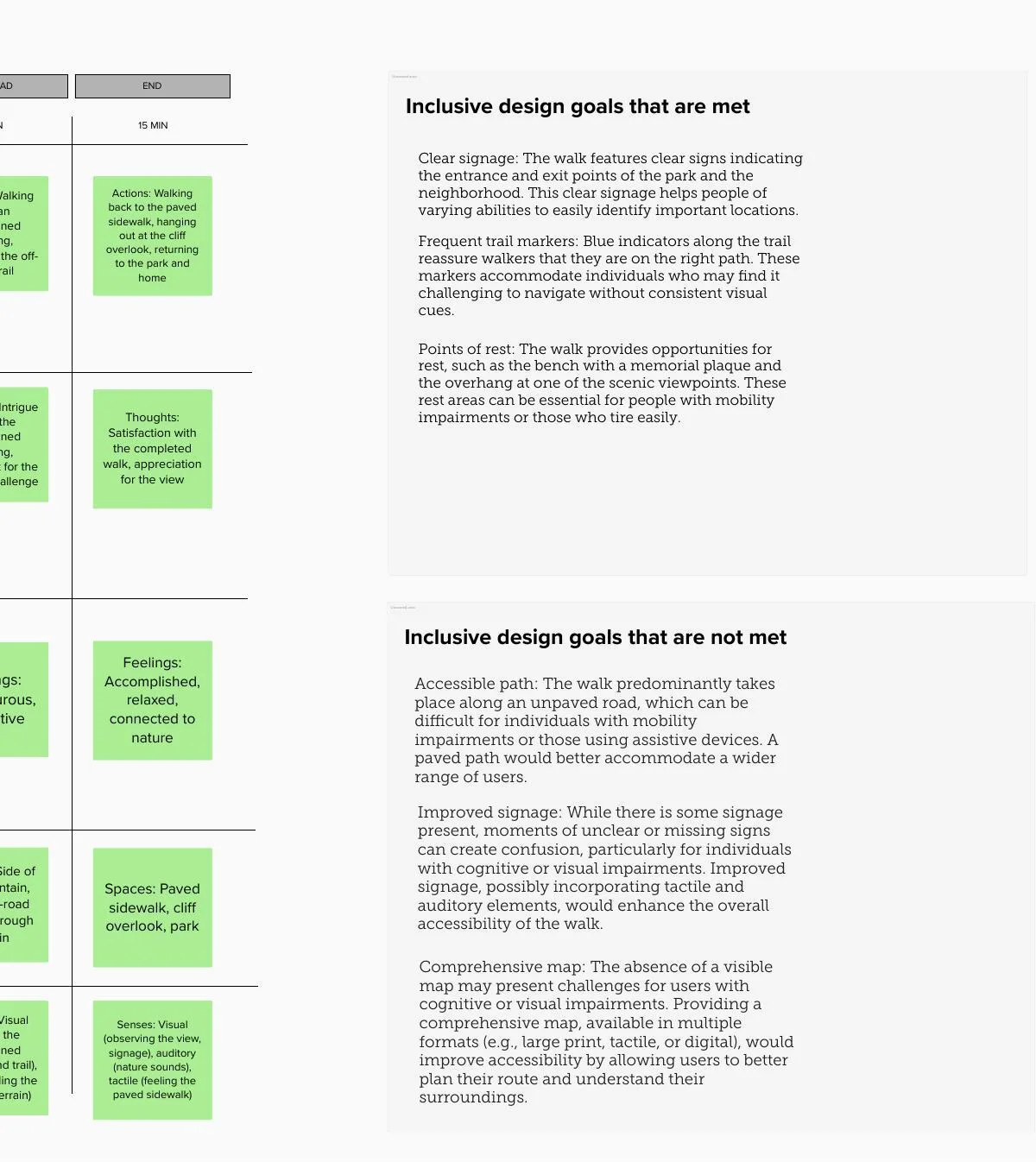
Clear entrances, frequent blue markers and places to rest are recorded as strengths. Unpaved surfaces, unclear or missing signs and the absence of a comprehensive map become provisional recommendations for paved access, multimodal wayfinding and route-planning information.
What came out of it
A single visual research artifact combining field photography, journey mapping and an inclusive-design critique of navigation, terrain and rest.
Repeat the audit with disabled participants and local stakeholders, verify the route against current conditions, and prototype tactile, audible, large-print and digital wayfinding before making implementation claims.
Additional views and the assets discussed above. Open images for their full composition; videos use native playback controls.
Documented surfaces, landmarks, signage, rest points and moments of uncertainty along the route.
Connected time, actions, thoughts, feelings, spaces and senses across five route stages.
Separated observed supports from potential mobility, visual and cognitive barriers while keeping recommendations provisional.
No AI tools were used on this project.
Let's talk. I'm open to junior experiential, exhibition, spatial, service and product design roles — Toronto-area hybrid, remote, or contract.